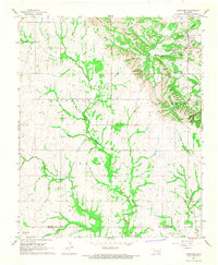
1967 Map of Fittstown
USGS Topo · Published 1968About this map
The Blue River and West Blue River carve a deep drainage network through this portion of Oklahoma, where the local economy centers on mineral extraction and agriculture. Industrial activity is concentrated in the northeast at the Fittstown Oil Field, while numerous quarries dot the eastern ridges. The small settlement of Fittstown serves as a local hub, supported by smaller hamlets such as Franks, which sits near the headwaters of Walnut Creek.
Find a feature on this map
25 named features on this map. Tap any name to fly to it.
Don’t see what you’re looking for? This feature index may not catch every label — zoom into the map to look around manually.
Map Details
Editions of this 1967 Fittstown Map
2 editions found
Other maps of this area

1901 · Stonewall
USGS Topo · 1:125,000

1901 · Tishomingo
USGS Topo · 1:125,000

1957 · Stonewall
USGS Topo · 1:24,000

1957 · Ardmore
USGS Topo · 1:250,000

1963 · Ardmore
USGS Topo · 1:250,000

1963 · Mill Creek
USGS Topo · 1:24,000
1966 · Harden City
USGS Topo · 1:24,000

1967 · Roff South
USGS Topo · 1:24,000

1967 · Ahloso
USGS Topo · 1:24,000

1967 · Connerville
USGS Topo · 1:24,000