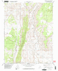
1981 Map of Fivemile Valley
USGS Topo · Published 1981About this map
The Cockscomb dominates this part of southern Utah, forming a dramatic geological divide between Fivemile Valley to the west and the Paria River corridor to the east. Evidence of early resource extraction and land use is visible at the Hattie Green Mine along the ridge and a small Cem located near the northern reaches of Cottonwood Creek. The landscape is defined by its drainage systems and natural catchment areas, such as Fivemile Spring and Rock House Cove. Transportation through this arid environment follows the natural contours of the land, with Highway 89 skirting the southern edge near Catstair Canyon and The Rimrocks. The mapping reveals a transition between the elevated Brigham Plains and the intricate network of washes like Sand Gulch that feed into the local waterways.
Find a feature on this map
18 named features on this map. Tap any name to fly to it.
Don’t see what you’re looking for? This feature index may not catch every label — zoom into the map to look around manually.
Map Details
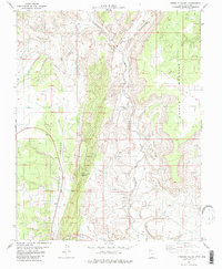
Editions of this 1981 Fivemile Valley Map
3 editions found

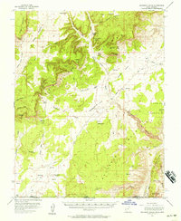
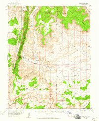
Other maps of this area

1886 · Kanab
USGS Topo · 1:250,000

1886 · Escalante
USGS Topo · 1:250,000

1953 · Cedar City
USGS Topo · 1:250,000

1954 · Buckskin Gulch NE
USGS Topo · 1:24,000

1954 · Buckskin Gulch SE
USGS Topo · 1:24,000

1954 · Paria NW
USGS Topo · 1:24,000

1954 · Paria SW
USGS Topo · 1:24,000
1954 · Buckskin Gulch
USGS Topo · 1:62,500
1954 · Paria
USGS Topo · 1:62,500

1955 · The Cockscob SW
USGS Topo · 1:24,000