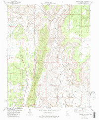
1981 Map of Fivemile Valley
USGS Topo · Published 1981About this map
The Cockscomb dominates this portion of Kane County, creating a sharp geological spine that separates the lower reaches of Brigham Plains from the broad expanse of Fivemile Valley. This 1981 survey documents a landscape where seasonal water and rare permanent sources like Fivemile Spring dictated human movement and industry. Evidence of local enterprise is found at the Hattie Green Mine, while a solitary Cem near the northern boundary points to the small-scale settlement history of the area.
Find a feature on this map
17 named features on this map. Tap any name to fly to it.
Don’t see what you’re looking for? This feature index may not catch every label — zoom into the map to look around manually.
Map Details
Editions of this 1981 Fivemile Valley Map
3 editions found
Other maps of this area

1886 · Kanab
USGS Topo · 1:250,000

1886 · Escalante
USGS Topo · 1:250,000

1953 · Cedar City
USGS Topo · 1:250,000

1954 · Buckskin Gulch NE
USGS Topo · 1:24,000

1954 · Buckskin Gulch SE
USGS Topo · 1:24,000

1954 · Paria NW
USGS Topo · 1:24,000
1954 · Paria SW
USGS Topo · 1:24,000

1954 · Buckskin Gulch
USGS Topo · 1:62,500

1954 · Paria
USGS Topo · 1:62,500

1955 · The Cockscob SW
USGS Topo · 1:24,000