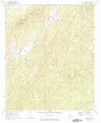
1971 Map of Flag Mountain
USGS Topo · Published 1984About this map
Weogufka State Forest anchors the northern high ground of this Coosa County landscape, where Flagg Mountain rises as a prominent landmark topped with a Lookout Tower and Radio Tower. The terrain is deeply carved by the winding course of Hatchet Creek and its many tributaries, including Weogufka Creek and Jack Creek. This 1971 survey shows a rural settlement pattern defined by small communities such as Bentleyville, Hillwood, and Moriah, often centered around local congregations like Mt Moriah Ch and Flint Hill Ch. Genealogists will find several rural burial grounds, including Liberty Hill Cem and Old Union Cem, which reflect the localized family history of these ridge-and-valley hamlets. Evidence of traditional river crossings remains visible at Tyler Ford, illustrating the historic dependence on natural water access points before modern infrastructure fully transformed the county's backroads.
Find a feature on this map
36 named features on this map. Tap any name to fly to it.
Don’t see what you’re looking for? This feature index may not catch every label — zoom into the map to look around manually.
Map Details
Editions of this 1971 Flag Mountain Map
2 editions found
Other maps of this area

1890 · Talladega
USGS Topo · 1:125,000

1892 · Talladega
USGS Topo · 1:125,000

1901 · Wetumpka
USGS Topo · 1:125,000

1903 · Wetumpka
USGS Topo · 1:125,000

1915 · Gantts Quarry
USGS Topo · 1:48,000

1917 · Gantts Quarry
USGS Topo · 1:62,500

1944 · Goodwater
USGS Topo · 1:62,500

1947 · Goodwater
USGS Topo · 1:62,500

1953 · Montgomery
USGS Topo · 1:250,000

1953 · Birmingham
USGS Topo · 1:250,000