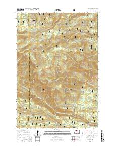
2017 Map of Flag Point
USGS Topo · Published 2017About this map
Mount Hood National Forest dominates this high-altitude landscape in Wasco and Hood River counties, characterized by a complex network of ridges, springs, and water-management features. The map illustrates the sophisticated irrigation and water-diversion efforts in the region, featuring systems like the Highland Ditch, Springer Ditch, and the winding course of Threemile Cr. Peaks and promontories such as Jordan Butte, Gordon Butte, and Flag Point serve as primary landmarks, while scattered water sources like Three Bear Spring and Shadley Spring provide essential points of interest for those tracing the historical geography of these uplands. Forestry management and access are clearly defined through the presence of various development roads, including Nat For Dev Rd 4811 and the Flag Point Lookout Rd, which leads toward the higher elevations.
Find a feature on this map
60 named features on this map. Tap any name to fly to it.
Don’t see what you’re looking for? This feature index may not catch every label — zoom into the map to look around manually.
Map Details
Editions of this 2017 Flag Point Map
This is the sole edition of this map. No revisions or reprints were ever made.
Other maps of this area

1924 · Mount Hood
USGS Topo · 1:125,000

1927 · Mount Hood
USGS Topo · 1:125,000

1930 · Dufur
USGS Topo · 1:125,000

1934 · Dufur
USGS Topo · 1:125,000

1953 · The Dalles
USGS Topo · 1:250,000

1956 · The Dalles
USGS Topo · 1:250,000

1956 · Mt. Wilson
USGS Topo · 1:62,500

1957 · The Dalles
USGS Topo · 1:250,000

1962 · Wolf Run
USGS Topo · 1:24,000

1962 · Rock Creek Reservoir
USGS Topo · 1:24,000