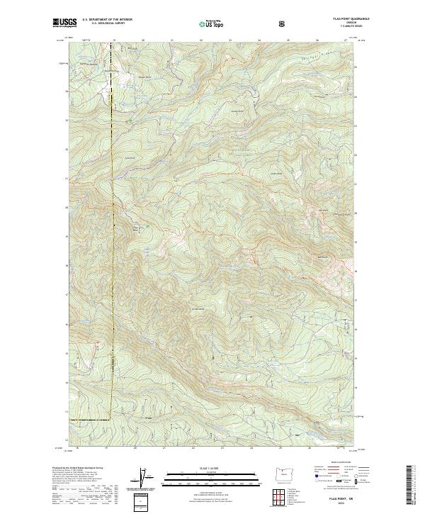
2023 Map of Flag Point
USGS Topo · Published 2023About this map
The Fifteenmile Creek Wild and Scenic River and the Badger Creek Wilderness dominate this high-elevation landscape within the Mount Hood National Forest. The map documents a complex network of recreational and access trails, such as the Lookout Mountain Trl and Fret Creek Trl, which navigate the steep transition between peaks like Bulo Point and the basin containing Oval Lake. Evidence of water management in this arid alpine environment is visible through the presence of the Springer Ditch in the north and the Highland Ditch in the southeast, infrastructure used to divert runoff from local drainages like Badger Creek. Named springs such as Shadley Spring and Cedar Creek Spring dot the terrain, serving as critical water sources between prominent overlooks like Flag Point and Gordon Butte.
Find a feature on this map
67 named features on this map. Tap any name to fly to it.
Don’t see what you’re looking for? This feature index may not catch every label — zoom into the map to look around manually.
Map Details
Editions of this 2023 Flag Point Map
This is the sole edition of this map. No revisions or reprints were ever made.
Other maps of this area

1924 · Mount Hood
USGS Topo · 1:125,000

1927 · Mount Hood
USGS Topo · 1:125,000

1930 · Dufur
USGS Topo · 1:125,000

1934 · Dufur
USGS Topo · 1:125,000

1953 · The Dalles
USGS Topo · 1:250,000

1956 · The Dalles
USGS Topo · 1:250,000

1956 · Mt. Wilson
USGS Topo · 1:62,500

1957 · The Dalles
USGS Topo · 1:250,000

1962 · Wolf Run
USGS Topo · 1:24,000

1962 · Rock Creek Reservoir
USGS Topo · 1:24,000