
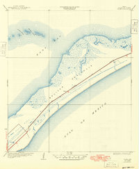
1933 Map of Flake
USGS Topo · Published 1933About this map
Bolivar Peninsula stretches between the Gulf of Mexico and East Bay in this 1931 survey, which captures the narrow coastal landscape before significant modern development. The map prominently features the transportation corridor that defined this stretch of the Texas coast, centered on the Gulf Colorado and Santa Fe railroad and the parallel State Highway No 124. The small settlement of Flake stands as the primary inland landmark along this route.
Find a feature on this map
10 named features on this map. Tap any name to fly to it.
Don’t see what you’re looking for? This feature index may not catch every label — zoom into the map to look around manually.
Map Details
Editions of this 1933 Flake Map
2 editions found
Other maps of this area

1930 · Galveston
USGS Topo · 1:24,000

1931 · Flake
USGS Topo · 1:24,000

1931 · Frozen Point
USGS Topo · 1:24,000

1932 · Bolivar Point
USGS Topo · 1:24,000

1933 · Frozen Point
USGS Topo · 1:31,680

1933 · Caplen
USGS Topo · 1:31,680

1933 · The Jetties
USGS Topo · 1:31,680

1933 · Whites Lake
USGS Topo · 1:31,680

1933 · Smith Point
USGS Topo · 1:31,680

1933 · Bolivar Point
USGS Topo · 1:31,680