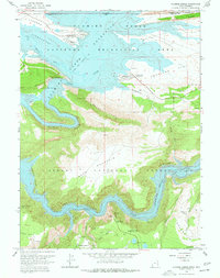
1966 Map of Flaming Gorge
USGS Topo · Published 1977About this map
Flaming Gorge Reservoir dominates this landscape along the Wyoming and Utah border, marking a period of significant hydrological and recreational development in the mid-1960s. The impounded Green River winds through dramatic geological formations like Horseshoe Canyon and the Red Canyon, while the Flaming Gorge National Recreation Area and Ashley National Forest provide organized infrastructure for the era's growing outdoor tourism. Early residential and utility footprints appear at Lucerne Valley Development and Antelope Flat Development.
Find a feature on this map
50 named features on this map. Tap any name to fly to it.
Don’t see what you’re looking for? This feature index may not catch every label — zoom into the map to look around manually.
Map Details
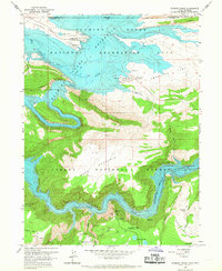
Editions of this 1966 Flaming Gorge Map
2 editions found
Other maps of this area

1885 · Ashley
USGS Topo · 1:250,000

1906 · Marsh Peak
USGS Topo · 1:125,000

1908 · Marsh Peak
USGS Topo · 1:125,000

1952 · Dutch John Mtn
USGS Topo · 1:24,000

1952 · Flaming Gorge
USGS Topo · 1:24,000

1954 · Vernal
USGS Topo · 1:250,000

1954 · Rock Springs
USGS Topo · 1:250,000

1957 · Currant Creek Ranch
USGS Topo · 1:62,500

1958 · Vernal
USGS Topo · 1:250,000

1958 · Rock Springs
USGS Topo · 1:250,000