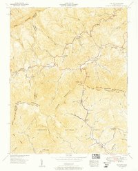
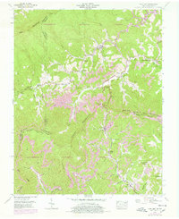
1955 Map of Flat Gap
USGS Topo · Published 1956About this map
The Kentucky Virginia border runs along the high crest of Pine Mountain in this 1950s survey, delineating the rugged boundary between Letcher and Wise counties. This landscape is defined by its deep drainage basins, where the headwaters of the Cumberland River and Powell River originate on opposite sides of the Tennessee Valley Divide. The settlement pattern follows these narrow valley floors, concentrated in small hubs like Flat Gap and Gilley.
Find a feature on this map
62 named features on this map. Tap any name to fly to it.
Don’t see what you’re looking for? This feature index may not catch every label — zoom into the map to look around manually.
Map Details
Editions of this 1955 Flat Gap Map
5 editions found
Other maps of this area

1890 · Whitesburg
USGS Topo · 1:125,000

1892 · Whitesburg
USGS Topo · 1:125,000

1894 · Estillville
USGS Topo · 1:125,000

1912 · Pound
USGS Topo · 1:48,000

1913 · Oven Fork
USGS Topo · 1:48,000

1914 · Pound
USGS Topo · 1:62,500

1915 · Whitesburg
USGS Topo · 1:62,500

1920 · Wise
USGS Topo · 1:48,000

1921 · Big Stone Gap
USGS Topo · 1:48,000

1921 · Wise
USGS Topo · 1:62,500