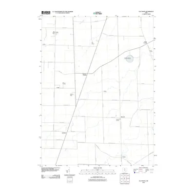
2010 Map of Flat Rock
USGS Topo · Published 2010About this map
The Sorrowfull Mother Shrine sits as a prominent spiritual landmark in this northern Ohio landscape, surrounded by a network of rural hamlets including Flat Rock, Bismarck, and Reedtown. The area is characterized by a dense concentration of local heritage sites, particularly religious grounds such as Saint Michaels Cemetery and Saint Sebastian Catholic Cemetery. These points of interest are linked by a grid of agricultural thoroughfares and historically significant routes like Old Military Rd.
Find a feature on this map
43 named features on this map. Tap any name to fly to it.
Don’t see what you’re looking for? This feature index may not catch every label — zoom into the map to look around manually.
Map Details
Editions of this 2010 Flat Rock Map
This is the sole edition of this map. No revisions or reprints were ever made.
Other maps of this area

1901 · Bellevue
USGS Topo · 1:62,500

1903 · Bellevue
USGS Topo · 1:62,500

1904 · Sandusky
USGS Topo · 1:62,500

1915 · Norwalk
USGS Topo · 1:62,500

1915 · Siam
USGS Topo · 1:62,500

1944 · Norwalk
USGS Topo · 1:62,500

1956 · Toledo
USGS Topo · 1:250,000

1959 · Kimball
USGS Topo · 1:24,000
1959 · Bellevue
USGS Topo · 1:24,000
1959 · Clyde
USGS Topo · 1:24,000