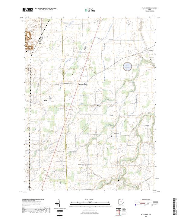
2023 Map of Flat Rock
USGS Topo · Published 2023About this map
Huron-Seneca Co Line Rd serves as a primary axis through this rural landscape, dividing the agricultural heartlands of Seneca and Huron Counties. Several small hamlets and crossroads define the settlement pattern, including Flat Rock, Reedtown, Bismarck, and Weavers Corners. The topography is subtly marked by the winding paths of Frink Run and Megginson Creek, which drain toward the Bellevue Reservoir.
Find a feature on this map
63 named features on this map. Tap any name to fly to it.
Don’t see what you’re looking for? This feature index may not catch every label — zoom into the map to look around manually.
Map Details
Editions of this 2023 Flat Rock Map
This is the sole edition of this map. No revisions or reprints were ever made.
Other maps of this area

1901 · Bellevue
USGS Topo · 1:62,500

1903 · Bellevue
USGS Topo · 1:62,500

1904 · Sandusky
USGS Topo · 1:62,500

1915 · Norwalk
USGS Topo · 1:62,500

1915 · Siam
USGS Topo · 1:62,500

1944 · Norwalk
USGS Topo · 1:62,500

1956 · Toledo
USGS Topo · 1:250,000

1959 · Kimball
USGS Topo · 1:24,000
1959 · Bellevue
USGS Topo · 1:24,000
1959 · Clyde
USGS Topo · 1:24,000