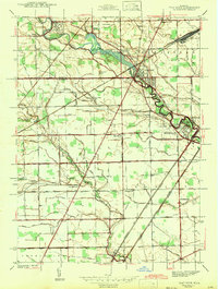
1942 Map of Flat Rock
USGS Topo · Published 1942About this map
The Huron River meanders toward Lake Erie, carving a path through the borderlands of Wayne and Monroe Counties during the early 1940s. This survey illustrates the established industrial and transport infrastructure of the Detroit-Toledo corridor, anchored by the riverfront settlements of Flat Rock and Rockwood. The landscape is defined by a dense grid of rural roads and heavy rail lines, including the Michigan Central Railroad and New York Central Railroad, which facilitated the movement of goods and people across the region. Local community life is evidenced by numerous rural education centers like Maple Grove Sch and Ash Center Sch. Large commemorative spaces such as Michigan Memorial Park and Oakwood Cem contrast with the productive agricultural drainage of Port Creek and Swan Creek, showing a transition from early farming roots toward suburban and industrial growth.
Find a feature on this map
47 named features on this map. Tap any name to fly to it.
Don’t see what you’re looking for? This feature index may not catch every label — zoom into the map to look around manually.
Map Details
Editions of this 1942 Flat Rock Map
2 editions found
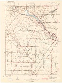
Other maps of this area

1906 · Wyandotte
USGS Topo · 1:62,500

1906 · Romulus
USGS Topo · 1:62,500

1912 · Wyandotte
USGS Topo · 1:62,500

1912 · Monroe
USGS Topo · 1:62,500

1914 · Monroe
USGS Topo · 1:62,500

1927 · Monroe
USGS Topo · 1:31,680

1928 · Romulus
USGS Topo · 1:62,500

1929 · Wyandotte
USGS Topo · 1:62,500

1936 · Wyandotte
USGS Topo · 1:31,680
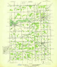
1936 · Belleville
USGS Topo · 1:31,680
Featured Places
- Brownstown Charter Township, MI
- Frenchtown Charter Township, MI
- Huron Charter Township, MI
- Woodhaven, MI
- Berlin Charter Township, MI