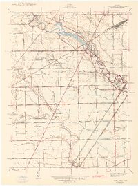
1942 Map of Flat Rock
USGS Topo · Published 1942About this map
The Huron River carves a winding path through the borderlands of Wayne and Monroe counties, anchoring a landscape defined by its early 1940s rail infrastructure and rural educational network. At Flat Rock, the confluence of various rail lines including the New York Central and the Detroit and Toledo Shore Line highlights the area's importance as a transportation corridor between major industrial hubs. The surveyor R. E. Altenhofen captured a detailed view of the transition from the concentrated settlement at Rockwood to the more dispersed farming communities of Huron and Brownstown townships.
Find a feature on this map
55 named features on this map. Tap any name to fly to it.
Don’t see what you’re looking for? This feature index may not catch every label — zoom into the map to look around manually.
Map Details
Editions of this 1942 Flat Rock Map
2 editions found
Other maps of this area

1906 · Wyandotte
USGS Topo · 1:62,500

1906 · Romulus
USGS Topo · 1:62,500

1912 · Wyandotte
USGS Topo · 1:62,500

1912 · Monroe
USGS Topo · 1:62,500

1914 · Monroe
USGS Topo · 1:62,500

1927 · Monroe
USGS Topo · 1:31,680

1928 · Romulus
USGS Topo · 1:62,500

1929 · Wyandotte
USGS Topo · 1:62,500

1936 · Wyandotte
USGS Topo · 1:31,680
1936 · Belleville
USGS Topo · 1:31,680
Featured Places
- Brownstown Charter Township, MI
- Frenchtown Charter Township, MI
- Huron Charter Township, MI
- Woodhaven, MI
- Berlin Charter Township, MI