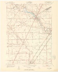
1952 Map of Flat Rock
USGS Topo · Published 1953About this map
The Huron River winds through this mid-century landscape, anchoring the industrial and transit corridors between Wayne and Monroe Counties. Extensive rail infrastructure defines the local economy, notably the large Flat Rock Yard and the intersection of the Pennsylvania RR and the New York Central RR. These tracks served the growing settlements of Flat Rock, Rockwood, and Newport, which appear here before the full expansion of the interstate era.
Find a feature on this map
51 named features on this map. Tap any name to fly to it.
Don’t see what you’re looking for? This feature index may not catch every label — zoom into the map to look around manually.
Map Details
Editions of this 1952 Flat Rock Map
2 editions found
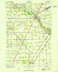
Other maps of this area

1906 · Wyandotte
USGS Topo · 1:62,500

1906 · Romulus
USGS Topo · 1:62,500

1912 · Wyandotte
USGS Topo · 1:62,500

1912 · Monroe
USGS Topo · 1:62,500

1914 · Monroe
USGS Topo · 1:62,500

1927 · Monroe
USGS Topo · 1:31,680

1928 · Romulus
USGS Topo · 1:62,500

1929 · Wyandotte
USGS Topo · 1:62,500

1936 · Wyandotte
USGS Topo · 1:31,680
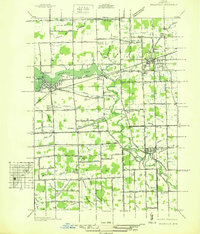
1936 · Belleville
USGS Topo · 1:31,680
Featured Places
- Brownstown Charter Township, MI
- Frenchtown Charter Township, MI
- Huron Charter Township, MI
- Woodhaven, MI
- Berlin Charter Township, MI