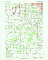
1967 Map of Flat Rock NE
USGS Topo · Published 1969About this map
The sprawling Detroit Metropolitan-Wayne County Airport dominates the northwestern corner of this landscape during a period of rapid suburban expansion in Wayne County. While the airport represents modern transit, the surrounding townships of Taylor and Brownstown retain traces of an older, rural layout. A vast network of drainage features, including the Blakely Drain and Sexton and Kilfoil Drain, illustrates the intensive effort to manage the low-lying terrain of the Texas Marsh region.
Find a feature on this map
110 named features on this map. Tap any name to fly to it.
Don’t see what you’re looking for? This feature index may not catch every label — zoom into the map to look around manually.
Map Details
Editions of this 1967 Flat Rock NE Map
Other maps of this area

1905 · Wayne
USGS Topo · 1:62,500

1905 · Detroit
USGS Topo · 1:62,500

1906 · Wyandotte
USGS Topo · 1:62,500

1906 · Romulus
USGS Topo · 1:62,500

1912 · Wyandotte
USGS Topo · 1:62,500

1912 · Wayne
USGS Topo · 1:62,500

1918 · Detroit
USGS Topo · 1:62,500

1924 · Detroit
USGS Topo · 1:62,500

1928 · Romulus
USGS Topo · 1:62,500

1929 · Wyandotte
USGS Topo · 1:62,500