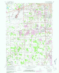
1967 Map of Flat Rock NE
USGS Topo · Published 1981About this map
The Detroit Metropolitan-Wayne County Airport dominates the northwestern portion of this Michigan landscape, showing the expansion of air travel infrastructure amidst a rapidly urbanizing corridor. In the cities of Romulus and Taylor, the map documents a transition from rural drainage patterns to dense residential development, highlighted by purple-tinted urban extensions. Local genealogy is well-supported by several burial sites, including West Mound Cem and Krause Cem, while the educational landscape is anchored by institutions like Taylor Center High Sch and John F Kennedy Sch. Industrial and commercial growth is evident along the Norfolk and Western Railway and the Detroit Toledo and Ironon tracks. Cultural landmarks of the era include a Drive-in Theater in Woodhaven and the sprawling Huron Metro Park along the southern border.
Find a feature on this map
84 named features on this map. Tap any name to fly to it.
Don’t see what you’re looking for? This feature index may not catch every label — zoom into the map to look around manually.
Map Details
Editions of this 1967 Flat Rock NE Map
Other maps of this area

1905 · Wayne
USGS Topo · 1:62,500

1905 · Detroit
USGS Topo · 1:62,500

1906 · Wyandotte
USGS Topo · 1:62,500

1906 · Romulus
USGS Topo · 1:62,500

1912 · Wyandotte
USGS Topo · 1:62,500

1912 · Wayne
USGS Topo · 1:62,500

1918 · Detroit
USGS Topo · 1:62,500

1924 · Detroit
USGS Topo · 1:62,500

1928 · Romulus
USGS Topo · 1:62,500

1929 · Wyandotte
USGS Topo · 1:62,500