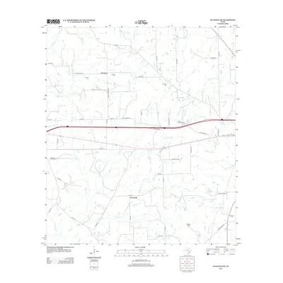
2013 Map of Flatonia NW
USGS Topo · Published 2013About this map
Newtonville and Armstrong anchor this landscape in Gonzales County, where a network of county roads and creek drainages defines the local geography. The area is marked by several significant burial grounds, including Andrews Chapel Cem and Castleman Cem, which offer essential reference points for genealogical research. The terrain is shaped by the headwaters of the Lavaca River and numerous tributaries such as Peach Cr, Little Fivemile Cr, and Cedar Cr. A prominent rise at Russell Hill overlooks the southern portion of the map, while Piano Ranch Airport indicates modern land use alongside established ranching and agricultural tracts. This 2013 survey provides a detailed look at the rural infrastructure of the region, from the private airstrip to the winding paths of Old Waelder Rd and Whistleville Rd.
Find a feature on this map
60 named features on this map. Tap any name to fly to it.
Don’t see what you’re looking for? This feature index may not catch every label — zoom into the map to look around manually.
Map Details
Editions of this 2013 Flatonia NW Map
This is the sole edition of this map. No revisions or reprints were ever made.
Other maps of this area

1901 · Flatonia
USGS Topo · 1:125,000

1953 · Seguin
USGS Topo · 1:250,000

1958 · Seguin
USGS Topo · 1:250,000

1962 · Dilworth
USGS Topo · 1:24,000

1964 · Waelder
USGS Topo · 1:24,000

1964 · Jeddo
USGS Topo · 1:24,000

1965 · Muldoon
USGS Topo · 1:24,000

1965 · Cistern
USGS Topo · 1:24,000

1965 · Komensky
USGS Topo · 1:24,000

1965 · Flatonia
USGS Topo · 1:24,000