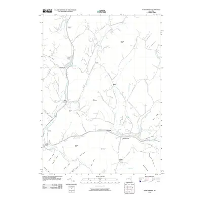
2010 Map of Fleischmanns
USGS Topo · Published 2010About this map
The East Branch Delaware River winds through this Catskill mountain terrain, anchoring a series of valley settlements from Halcottsville south toward Arkville. This landscape is defined by its deep hollows and high ridges, including Fleischmann Mountain and Belle Ayr Mountain, which overlook the concentrated development in Fleischmanns. The map captures a moment in the region's long-standing character as a summer retreat and rural hub, evidenced by Lake Switzerland and Wawaka Lake. Genealogists and local historians can locate several family-named burial grounds, such as Schemehorn Cemetery near the river and Scudder Cemetery further south. The orientation of roads like Kelly Corners-Denver-Vega Rd following the Batavia Kill and Red Kill reflects a settlement pattern dictated by the steep topography and narrow water-carved valleys.
Find a feature on this map
86 named features on this map. Tap any name to fly to it.
Don’t see what you’re looking for? This feature index may not catch every label — zoom into the map to look around manually.
Map Details
Editions of this 2010 Fleischmanns Map
This is the sole edition of this map. No revisions or reprints were ever made.
Other maps of this area

1900 · Phoenicia
USGS Topo · 1:62,500

1901 · Margaretville
USGS Topo · 1:62,500

1901 · Gilboa
USGS Topo · 1:62,500

1903 · Gilboa
USGS Topo · 1:62,500

1903 · Phoenicia
USGS Topo · 1:62,500

1904 · Hobart
USGS Topo · 1:62,500

1904 · Margaretville
USGS Topo · 1:62,500
1945 · Seager
USGS Topo · 1:24,000

1945 · West Kill
USGS Topo · 1:24,000

1945 · Fleischmanns
USGS Topo · 1:24,000