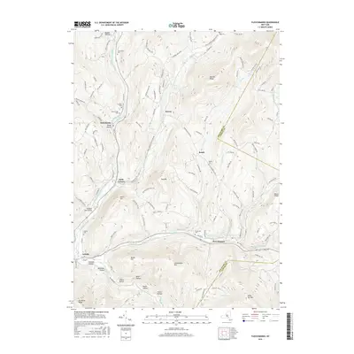
2016 Map of Fleischmanns
USGS Topo · Published 2016About this map
The East Branch Delaware River carves a deep valley through this Catskills landscape, anchoring a series of small settlements including Halcottsville, Kelly Corners, and Arkville. Higher elevation hamlets like Denver and Bedell sit tucked into the side valleys of the Batavia Kill and Red Kill. The terrain is defined by a series of named hollows—such as German Hollow, Negro Hollow, and Meeker Hollow—which suggest the diverse settlement patterns of earlier centuries. Local heritage is preserved in numerous family and community burial grounds, including the Schemehorn Cem, Scudder Cem, and Clovesville Cem near the village of Fleischmanns. The prominence of Fleischmann Mtn and Belle Ayr Mtn illustrates the significant vertical relief that shaped the development of transport routes along the Bush Kill and Dry Brook corridors.
Find a feature on this map
123 named features on this map. Tap any name to fly to it.
Don’t see what you’re looking for? This feature index may not catch every label — zoom into the map to look around manually.
Map Details
Editions of this 2016 Fleischmanns Map
This is the sole edition of this map. No revisions or reprints were ever made.
Other maps of this area

1900 · Phoenicia
USGS Topo · 1:62,500

1901 · Margaretville
USGS Topo · 1:62,500

1901 · Gilboa
USGS Topo · 1:62,500

1903 · Gilboa
USGS Topo · 1:62,500

1903 · Phoenicia
USGS Topo · 1:62,500

1904 · Hobart
USGS Topo · 1:62,500

1904 · Margaretville
USGS Topo · 1:62,500
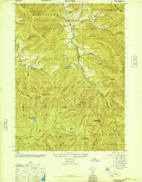
1945 · Seager
USGS Topo · 1:24,000

1945 · West Kill
USGS Topo · 1:24,000

1945 · Fleischmanns
USGS Topo · 1:24,000