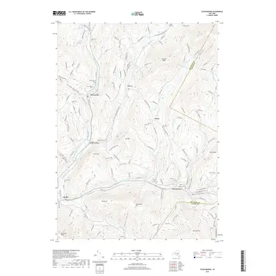
2019 Map of Fleischmanns
USGS Topo · Published 2019About this map
The East Branch Delaware River carves a deep valley through this Catskill landscape, anchoring settlements like Halcottsville and Arkville. At the turn of the 21st century, this area in Middletown exhibits a cluster of mountain hamlets connected by historic corridors like Old Rte 28. The mapping reveals a high density of small family and community burial grounds, including the Schemehorn Cem, Bedell Cem, and the Clovesville Irish Catholic Cem, which serve as vital markers for genealogical research in Delaware County. Higher elevations are dominated by significant peaks such as Fleischmann Mtn and Belle Ayr Mtn, while the southern reaches feature the Ashokan Trail and Cathedral Glen Trail. The village of Fleischmanns sits at the confluence of the Bush Kill and Vly Creek, maintaining its role as a regional hub amidst the ridges of Hog Mtn and Red Kill Ridge.
Find a feature on this map
48 named features on this map. Tap any name to fly to it.
Don’t see what you’re looking for? This feature index may not catch every label — zoom into the map to look around manually.
Map Details
Editions of this 2019 Fleischmanns Map
This is the sole edition of this map. No revisions or reprints were ever made.
Other maps of this area

1900 · Phoenicia
USGS Topo · 1:62,500

1901 · Margaretville
USGS Topo · 1:62,500

1901 · Gilboa
USGS Topo · 1:62,500

1903 · Gilboa
USGS Topo · 1:62,500

1903 · Phoenicia
USGS Topo · 1:62,500

1904 · Hobart
USGS Topo · 1:62,500

1904 · Margaretville
USGS Topo · 1:62,500
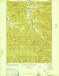
1945 · Seager
USGS Topo · 1:24,000

1945 · West Kill
USGS Topo · 1:24,000

1945 · Fleischmanns
USGS Topo · 1:24,000