2023 Map of Fleischmanns
USGS Topo · Published 2023About this map
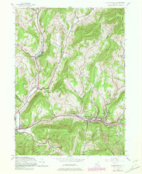
Fleischmanns and the surrounding high Catskill terrain define this modern survey of eastern Delaware County. The landscape is carved by the Batavia Kill and the East Branch Delaware River, where valley settlements like Kelly Corners and Halcottsville follow the winding watercourses. High elevation points such as Fleischmann Mountain and Belle Ayr Mountain dominate the geography, creating isolated hollows like Negro Hollow, Mine Hollow, and Reservoir Hollow. Local history and genealogy are well-preserved through numerous burial sites, including the Clovesville Irish Catholic Cem, Halcottsville Cem, and Vega Cem. The map illustrates a contemporary road network, from Main St in the village centers to remote routes like Carroll Hinkley Rd and the German Hollow Trail, reflecting the enduring settlement patterns established in these deep mountain valleys over generations.
Find a feature on this map
135 named features on this map. Tap any name to fly to it.
Don’t see what you’re looking for? This feature index may not catch every label — zoom into the map to look around manually.
Map Details
Editions of this 2023 Fleischmanns Map
This is the sole edition of this map. No revisions or reprints were ever made.
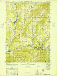
Historical Maps of Kelly Corners Through Time
3 maps found