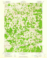
1960 Map of Fleming
USGS Topo · Published 1961About this map
The B & O Railroad cuts through the southern hills of Washington County, linking the settlement of Fleming with the industrial activity at Moore Junction near the Muskingum River. This 1960 survey highlights a landscape defined by deep creek valleys like Rainbow Creek and Turkeyhen Run, where narrow roads follow the ridgelines and hollows. Scattered throughout the townships of Watertown and Warren are numerous small family and community landmarks, including the Deming Cem and the St Johns Ch in Churchtown.
Find a feature on this map
55 named features on this map. Tap any name to fly to it.
Don’t see what you’re looking for? This feature index may not catch every label — zoom into the map to look around manually.
Map Details
Editions of this 1960 Fleming Map
3 editions found
Other maps of this area

1902 · Parkersburg
USGS Topo · 1:62,500

1903 · Macksburg
USGS Topo · 1:62,500

1904 · Parkersburg
USGS Topo · 1:62,500

1904 · Marietta
USGS Topo · 1:62,500

1905 · Macksburg
USGS Topo · 1:62,500

1909 · Caldwell
USGS Topo · 1:62,500

1912 · Caldwell
USGS Topo · 1:62,500

1924 · Marietta
USGS Topo · 1:62,500

1927 · Marietta
USGS Topo · 1:62,500

1949 · Clarksburg
USGS Topo · 1:250,000