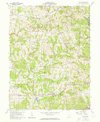
1960 Map of Fleming
USGS Topo · Published 1973About this map
Churchtown and Fleming anchor this landscape in Washington County, Ohio, during a period of transition for the local infrastructure. The terrain is marked by an extensive Gas And Oil Field, with numerous Oil Wells and Gas Wells scattered across the ridges and valleys between South Branch Wolf Creek and the Muskingum R. The transportation history of the area is visible through the presence of an Old Railroad Grade and a Tunnel, alongside a traditional Covered Bridge crossing Halfway Run.
Find a feature on this map
52 named features on this map. Tap any name to fly to it.
Don’t see what you’re looking for? This feature index may not catch every label — zoom into the map to look around manually.
Map Details
Editions of this 1960 Fleming Map
3 editions found
Other maps of this area

1902 · Parkersburg
USGS Topo · 1:62,500

1903 · Macksburg
USGS Topo · 1:62,500

1904 · Parkersburg
USGS Topo · 1:62,500

1904 · Marietta
USGS Topo · 1:62,500

1905 · Macksburg
USGS Topo · 1:62,500

1909 · Caldwell
USGS Topo · 1:62,500

1912 · Caldwell
USGS Topo · 1:62,500

1924 · Marietta
USGS Topo · 1:62,500

1927 · Marietta
USGS Topo · 1:62,500

1949 · Clarksburg
USGS Topo · 1:250,000