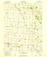
1961 Map of Fletcher
USGS Topo · Published 1962About this map
The agricultural landscape of eastern Miami County and western Champaign County is defined by its organized grid of farm roads and the winding paths of several key waterways. Fletcher serves as a primary hub in the southwest, while the nearby villages of Conover and Lena sit along the Pennsylvania railroad line. This 1961 survey captures the rural character of the region just before the expansion of modern infrastructure, showing numerous family-named landmarks and rural institutions such as the Miami East Jr High Sch.
Find a feature on this map
78 named features on this map. Tap any name to fly to it.
Don’t see what you’re looking for? This feature index may not catch every label — zoom into the map to look around manually.
Map Details
Editions of this 1961 Fletcher Map
3 editions found
Other maps of this area

1913 · Bellefontaine
USGS Topo · 1:48,000

1913 · Sidney
USGS Topo · 1:62,500

1914 · Troy
USGS Topo · 1:62,500

1914 · St. Paris
USGS Topo · 1:62,500

1915 · Bellefontaine
USGS Topo · 1:62,500

1916 · St. Paris
USGS Topo · 1:62,500

1944 · Sidney
USGS Topo · 1:62,500

1944 · St. Paris
USGS Topo · 1:62,500

1944 · Troy
USGS Topo · 1:62,500

1944 · Bellefontaine
USGS Topo · 1:62,500