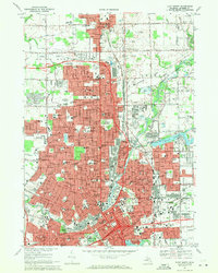
1969 Map of Flint North
USGS Topo · Published 1971About this map
The industrial and civic core of Genesee County is documented here as the city of Flint expands northward toward Mount Morris. This late 1960s landscape is defined by a dense network of neighborhood institutions, including St Marys Sch, Beecher High Sch, and Sacred Heart Sch, alongside large-scale medical facilities like McLaren Hospital and St Joseph Hospital. The Chesapeake and Ohio railroad corridor anchors the industrial heart of the region, passing by McGrew Junction and numerous Gravel Pits.
Find a feature on this map
128 named features on this map. Tap any name to fly to it.
Don’t see what you’re looking for? This feature index may not catch every label — zoom into the map to look around manually.
Map Details
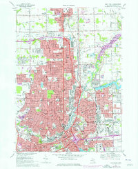
Editions of this 1969 Flint North Map
2 editions found
Other maps of this area

1919 · Burt
USGS Topo · 1:62,500

1920 · Flint
USGS Topo · 1:62,500

1920 · Holly
USGS Topo · 1:62,500

1921 · Burt
USGS Topo · 1:62,500

1922 · Holly
USGS Topo · 1:62,500

1922 · Durand
USGS Topo · 1:62,500

1922 · Flint
USGS Topo · 1:62,500

1943 · Holly
USGS Topo · 1:62,500

1943 · Burt
USGS Topo · 1:62,500

1943 · Durand
USGS Topo · 1:62,500