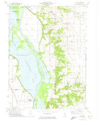
1972 Map of Florid
USGS Topo · Published 1974About this map
The Illinois River corridor dominates this 1970s landscape, shaping the development of Hennepin and its riverfront infrastructure. The settlement's western edge is defined by the expansive Senachwine Lake and the industrial presence of the Chicago Rock Island and Pacific railroad, which tracks along the river's lower bends. The map details the transition from the low-lying wetlands of Sawmill Lake and Goose Lake to the higher ground of the Hennepin and Granville townships. Local heritage is preserved through several family and community burial grounds, including Riverside Cem, Union Grove Cem, and Murphy Cem. While the river valley serves as a hub for transport and utility, shown by the Pumping Station and Gaging Station, the eastern uplands around Florid remain agricultural, punctuated by numerous Gravel Pit operations that reflect the local geology.
Find a feature on this map
28 named features on this map. Tap any name to fly to it.
Don’t see what you’re looking for? This feature index may not catch every label — zoom into the map to look around manually.
Map Details
Editions of this 1972 Florid Map
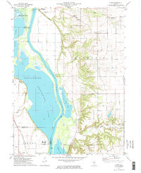
2 editions found
Other maps of this area

1893 · Lacon
USGS Topo · 1:62,500

1893 · Hennepin
USGS Topo · 1:62,500

1893 · Lasalle
USGS Topo · 1:62,500

1909 · Hennepin
USGS Topo · 1:62,500

1911 · La Salle
USGS Topo · 1:62,500

1911 · Hennepin
USGS Topo · 1:62,500

1913 · La Salle
USGS Topo · 1:62,500

1933 · Lacon
USGS Topo · 1:62,500

1934 · Wenona
USGS Topo · 1:48,000

1937 · Lacon
USGS Topo · 1:62,500