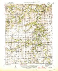
1945 Map of Florida
USGS Topo · Published 1945About this map
Paris serves as the western anchor of this mid-century landscape, where the Middle Fork Salt River and Elk Fork Salt River begin their winding confluence through northeastern Missouri. This 1945 survey documents a dense network of rural infrastructure, recording dozens of one-room schoolhouses like McGee Sch and Sharp Sch alongside community landmarks such as the County Infirmary. The terrain is defined by the serpentine paths of the South Fork Salt River and its many tributaries, which carved the deep valleys that would later be transformed by reservoir projects.
Find a feature on this map
69 named features on this map. Tap any name to fly to it.
Don’t see what you’re looking for? This feature index may not catch every label — zoom into the map to look around manually.
Map Details
Editions of this 1945 Florida Map
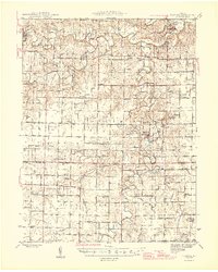
3 editions found
Other maps of this area

1890 · Mexico
USGS Topo · 1:125,000

1890 · Moberly
USGS Topo · 1:125,000

1903 · Palmyra
USGS Topo · 1:125,000

1932 · Mexico
USGS Topo · 1:62,500

1942 · Wellsville
USGS Topo · 1:62,500

1945 · Florida
USGS Topo · 1:62,500

1945 · Perry
USGS Topo · 1:62,500

1945 · Centralia
USGS Topo · 1:62,500

1948 · Quincy
USGS Topo · 1:250,000

1953 · Moberly
USGS Topo · 1:250,000