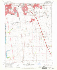
1968 Map of Florin
USGS Topo · Published 1970About this map
Sacramento expands southward into agricultural lands in this late-1960s survey, showing the transition of dairy and farmland into suburban residential blocks. The area around the historic community of Florin is increasingly dominated by modern infrastructure, including the Florin Square Shopping Center and a series of newly constructed schools like Burbank High Sch and Rutter Jr High Sch. Despite this growth, the rural character remains evident in the wide grids of Sheldon Road and Elk Grove Blvd, where numerous wells and gaging stations dot the landscape between Morrison Creek and Laguna Creek.
Find a feature on this map
67 named features on this map. Tap any name to fly to it.
Don’t see what you’re looking for? This feature index may not catch every label — zoom into the map to look around manually.
Map Details
Editions of this 1968 Florin Map
3 editions found
Other maps of this area

1891 · Sacramento
USGS Topo · 1:125,000

1892 · Sacramento
USGS Topo · 1:125,000

1893 · Sacramento
USGS Topo · 1:125,000

1894 · Lodi
USGS Topo · 1:125,000

1902 · Fairoaks
USGS Topo · 1:62,500

1907 · Davisville
USGS Topo · 1:62,500

1908 · Courtland
USGS Topo · 1:62,500

1909 · Elk Grove
USGS Topo · 1:31,680

1909 · Florin
USGS Topo · 1:31,680

1910 · Bruceville
USGS Topo · 1:31,680