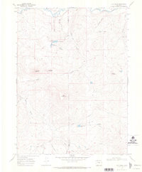
1969 Map of Fly Creek
USGS Topo · Published 1972About this map
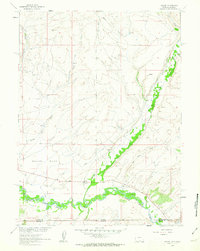
The Little Snake River winds across the northern reaches of this high-elevation landscape, where the boundary between Moffat and Routt Counties meets in a region defined by alpine hydrology and complex terrain. Numerous small bodies of water and reservoirs dot the highlands, including the Lower Cogdill Lake, Upper Cogdill Lake, and Slater Creek Lake. The map captures a moment in the late 1960s when resource exploration left its mark in the form of several remote Drill Holes and a network of Jeep Trails used for access. Distinctive peaks such as Bible Back Mountain, Camel Back Mountain, and Yahoo Mountain rise above the complex drainage systems of Slater Creek, Pat Creek, and the Roaring Fork Slater Creek, showing the intricate natural watershed before further modern development.
Find a feature on this map
30 named features on this map. Tap any name to fly to it.
Don’t see what you’re looking for? This feature index may not catch every label — zoom into the map to look around manually.
Map Details
Editions of this 1969 Fly Creek Map
4 editions found
Other maps of this area

1932 · Savery
USGS Topo · 1:96,000

1940 · Savery
USGS Topo · 1:125,000

1954 · Rawlins
USGS Topo · 1:250,000

1954 · Craig
USGS Topo · 1:250,000

1957 · Craig
USGS Topo · 1:250,000

1958 · Rawlins
USGS Topo · 1:250,000

1958 · Craig
USGS Topo · 1:250,000

1960 · Craig
USGS Topo · 1:250,000
1961 · Savery
USGS Topo · 1:24,000

1961 · Grieve Reservoir
USGS Topo · 1:24,000