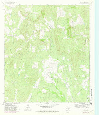
1962 Map of Fly Gap
USGS Topo · Published 1982About this map
The small community of Fly Gap anchors this central Texas landscape, characterized by isolated peaks and seasonal watercourses in the early 1960s. Family names are prominent across the terrain, notably at the Eaton Cem, Lester Cem, and Kothmann Cem, offering essential data for genealogists tracking early settlers in this region of Mason County. Education and social life centered on the Fly Gap Sch, while the nearby Fly Gap Cem served the immediate hamlet.
Find a feature on this map
30 named features on this map. Tap any name to fly to it.
Don’t see what you’re looking for? This feature index may not catch every label — zoom into the map to look around manually.
Map Details
Editions of this 1962 Fly Gap Map
2 editions found
Other maps of this area

1887 · Llano
USGS Topo · 1:125,000

1887 · Mason
USGS Topo · 1:125,000

1894 · Mason
USGS Topo · 1:125,000

1894 · Llano
USGS Topo · 1:125,000

1904 · Llano
USGS Topo · 1:125,000

1909 · Llano
USGS Topo · 1:125,000

1918 · Llano
USGS Topo · 1:125,000

1954 · Llano
USGS Topo · 1:250,000

1955 · Llano
USGS Topo · 1:250,000
1955 · Smoothingiron Mountain
USGS Topo · 1:24,000