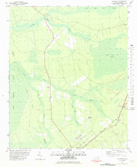
1981 Map of Folkstone
USGS Topo · Published 1981About this map
Great Sandy Run Pocosin dominates the eastern landscape of this coastal plain region, representing a classic Carolina wetland environment defined by its peat-rich soil and dense vegetation. The 1981 mapping shows the area's transportation infrastructure anchored by the Seaboard Coast Line Railroad, which runs near the settlement of Folkstone. The terrain is deeply influenced by a complex network of wetlands, including Shelter Swamp, Holly Swamp, and Juniper Swamp, which dictate the patterns of human development. Notable historical features include an Abandoned Landing Strip located west of the railroad, and the jurisdictional boundary between Onslow and Pender Counties. The map captures the quiet transition between the concentrated settlement of Holly Ridge and the surrounding timberlands and creeks like Kings Creek.
Find a feature on this map
19 named features on this map. Tap any name to fly to it.
Don’t see what you’re looking for? This feature index may not catch every label — zoom into the map to look around manually.
Map Details
Editions of this 1981 Folkstone Map
2 editions found
Other maps of this area

1942 · Spicer Bay
USGS Topo · 1:62,500

1942 · Topsail
USGS Topo · 1:62,500

1948 · Maple Hill
USGS Topo · 1:62,500

1948 · Topsail
USGS Topo · 1:62,500

1948 · New River
USGS Topo · 1:62,500

1952 · Jacksonville South
USGS Topo · 1:24,000

1952 · Spicer Bay
USGS Topo · 1:24,000

1952 · Sneads Ferry
USGS Topo · 1:24,000

1953 · Beaufort
USGS Topo · 1:250,000

1954 · Beaufort
USGS Topo · 1:250,000