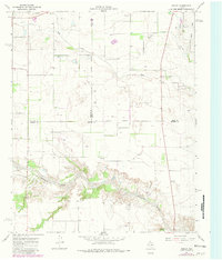
1967 Map of Folley
USGS Topo · Published 1981About this map
Quitaque Creek carves a complex, deeply eroded course across this landscape where the borders of Motley, Briscoe, and Hall counties converge. The settlement of Folley sits atop the plateau just north of these breaks, serving as a focal point for a region defined by cattle ranching and scattered agricultural infrastructure. This 1960s-era survey, updated in the early 1980s, reveals a period of transition in local recreation and transportation, evidenced by the presence of a Drive-in Theater and the Turkey Airfield near the northern boundary. The terrain transitions from the open stretches of Wolf Flat to the winding drainage of Kent Creek, with numerous wells and gravel pits indicating the importance of water management and local resource extraction in this corner of the Texas Panhandle.
Find a feature on this map
17 named features on this map. Tap any name to fly to it.
Don’t see what you’re looking for? This feature index may not catch every label — zoom into the map to look around manually.
Map Details
Editions of this 1967 Folley Map
2 editions found
Other maps of this area

1954 · Plainview
USGS Topo · 1:250,000

1958 · Plainview
USGS Topo · 1:250,000

1967 · Quitaque
USGS Topo · 1:24,000

1967 · North Windmill
USGS Topo · 1:24,000

1967 · Tampico Siding
USGS Topo · 1:24,000

1967 · Quitaque Peaks
USGS Topo · 1:24,000

1967 · Hornica Creek
USGS Topo · 1:24,000

1967 · Flomot
USGS Topo · 1:24,000

1967 · Turkey
USGS Topo · 1:24,000

1967 · Lake Theo
USGS Topo · 1:24,000