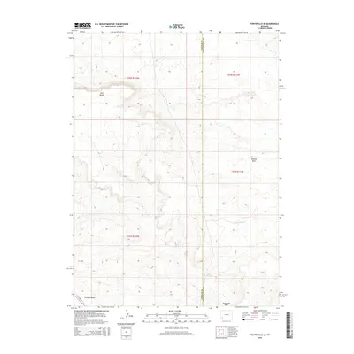
2015 Map of Fontenelle SE
USGS Topo · Published 2015About this map
Chrisman Bench and Opal Bench define the high plateaus of this Sweetwater County landscape, where the high desert meets the drainages of the Green River basin. This 2015 survey documents the arid terrain along the Lincoln and Sweetwater County line, a region defined by its wide basins and seasonal watercourses. The path of Old US Hwy 30 cuts across the southwestern corner, marking a historic transportation corridor through the sagebrush steppe. Water features are sparse but significant for the local ecology, including the S Fork Shute Cr and the drainage at Sevenmile Wash. To the north, Whiskey Basin provides a natural depression within the sprawling grid of public land surveys, illustrating the vast, open spaces characteristic of southwestern Wyoming's high plains.
Find a feature on this map
11 named features on this map. Tap any name to fly to it.
Don’t see what you’re looking for? This feature index may not catch every label — zoom into the map to look around manually.
Map Details
Editions of this 2015 Fontenelle SE Map
This is the sole edition of this map. No revisions or reprints were ever made.
Other maps of this area

1954 · Ogden
USGS Topo · 1:250,000

1954 · Rock Springs
USGS Topo · 1:250,000

1958 · Ogden
USGS Topo · 1:250,000

1958 · Rock Springs
USGS Topo · 1:250,000

1960 · Ogden
USGS Topo · 1:250,000

1961 · Sevenmile Gulch
USGS Topo · 1:24,000

1962 · Rock Springs
USGS Topo · 1:250,000
1963 · Whiskey Buttes
USGS Topo · 1:24,000
1963 · Mc Cullen Bluff
USGS Topo · 1:24,000

1969 · Church Butte NW
USGS Topo · 1:24,000