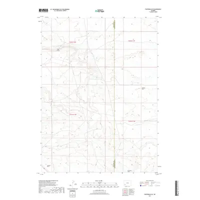
2017 Map of Fontenelle SE
USGS Topo · Published 2017About this map
Opal Bench and Chrisman Bench dominate this high-desert landscape in southwestern Wyoming, where the terrain is marked by broad plateaus and intermittent watercourses. In 2017, this area at the border of Lincoln and Sweetwater counties remained largely undeveloped, defined by its natural topography rather than human settlement. The drainage patterns of the S Fork Shute Cr and the drainage of Sevenmile Wash illustrate the arid hydrology of the region, where water flow is seasonal and linked to specific geographic basins like Whiskey Basin. The map captures the precise township and range grid across the high plains, providing a technical view of land management and surveying boundaries in a region where few permanent structures or roads exist.
Find a feature on this map
10 named features on this map. Tap any name to fly to it.
Don’t see what you’re looking for? This feature index may not catch every label — zoom into the map to look around manually.
Map Details
Editions of this 2017 Fontenelle SE Map
This is the sole edition of this map. No revisions or reprints were ever made.
Other maps of this area

1954 · Ogden
USGS Topo · 1:250,000

1954 · Rock Springs
USGS Topo · 1:250,000

1958 · Ogden
USGS Topo · 1:250,000

1958 · Rock Springs
USGS Topo · 1:250,000

1960 · Ogden
USGS Topo · 1:250,000

1961 · Sevenmile Gulch
USGS Topo · 1:24,000

1962 · Rock Springs
USGS Topo · 1:250,000
1963 · Whiskey Buttes
USGS Topo · 1:24,000
1963 · Mc Cullen Bluff
USGS Topo · 1:24,000

1969 · Church Butte NW
USGS Topo · 1:24,000