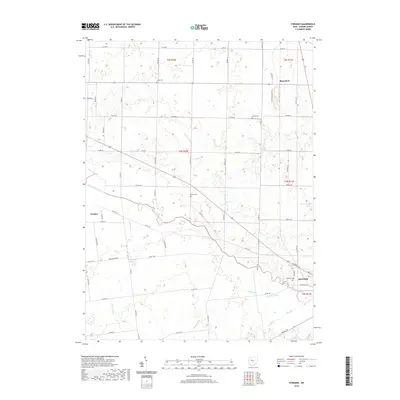
2019 Map of Foraker
USGS Topo · Published 2019About this map
The Scioto River meanders southeastward through this Hardin County landscape, defining the character of a region deeply shaped by its waterways and drainage systems. Near the river's bend, the city of Kenton anchors the southeast corner, revealing a street grid that transitions into a network of township roads and pikes, including Hanson Pike and Brielmaier Pike. These routes connect the smaller settlements of Foraker and Blanchard, illustrating a rural development pattern common to the Ohio till plains.
Find a feature on this map
63 named features on this map. Tap any name to fly to it.
Don’t see what you’re looking for? This feature index may not catch every label — zoom into the map to look around manually.
Map Details
Editions of this 2019 Foraker Map
This is the sole edition of this map. No revisions or reprints were ever made.
Other maps of this area

1905 · Arlington
USGS Topo · 1:62,500

1907 · Bluffton
USGS Topo · 1:62,500

1907 · Arlington
USGS Topo · 1:24,000

1913 · Alger
USGS Topo · 1:48,000

1915 · Alger
USGS Topo · 1:62,500

1915 · Kenton
USGS Topo · 1:62,500

1943 · Alger
USGS Topo · 1:62,500

1944 · Kenton
USGS Topo · 1:62,500

1950 · Marion
USGS Topo · 1:250,000
1960 · Roundhead
USGS Topo · 1:24,000