
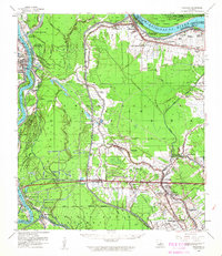
1959 Map of Fordoche
USGS Topo · Published 1962About this map
The Atchafalaya River and Mississippi River define this complex alluvial landscape in Pointe Coupee Parish, where the river's historic volatility is recorded by the Morganza Crevasse April 1890. This mid-century survey reveals a transition toward industrial extraction, with the Fordoche Oil and Gas Field and Lottie Oil and Gas Field established amid the traditional plantation landscape. The Texas & Pacific RR serves as a central artery for several small settlements and stops, including Fordoche, Lottie, and Morganza.
Find a feature on this map
84 named features on this map. Tap any name to fly to it.
Don’t see what you’re looking for? This feature index may not catch every label — zoom into the map to look around manually.
Map Details
Editions of this 1959 Fordoche Map
2 editions found
Other maps of this area

1906 · Bayou Sara
USGS Topo · 1:125,000

1935 · Osca Bayou
USGS Topo · 1:62,500

1939 · St. Francisville
USGS Topo · 1:62,500

1939 · Fordoche
USGS Topo · 1:62,500

1940 · Grosse Tete
USGS Topo · 1:62,500

1940 · Arnaudville
USGS Topo · 1:62,500

1941 · Batchelor
USGS Topo · 1:62,500

1953 · Maringouin
USGS Topo · 1:24,000

1953 · New Roads
USGS Topo · 1:24,000

1954 · Fordoche
USGS Topo · 1:24,000