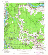
1959 Map of Fordoche
USGS Topo · Published 1962About this map
Pointe Coupee Parish and its complex relationship with the Mississippi and Atchafalaya river systems are documented here during the late 1950s. The landscape is dominated by the Atchafalaya Basin Floodway, a massive engineering response to previous disasters like the Morganza Crevasse April 1890 and the Melville Crevasse. Between these floodways, small agricultural and energy-based settlements like Fordoche, Lottie, and Livonia thrive along the Texas & Pacific RR.
Find a feature on this map
80 named features on this map. Tap any name to fly to it.
Don’t see what you’re looking for? This feature index may not catch every label — zoom into the map to look around manually.
Map Details
Editions of this 1959 Fordoche Map
2 editions found

Other maps of this area

1906 · Bayou Sara
USGS Topo · 1:125,000

1935 · Osca Bayou
USGS Topo · 1:62,500

1939 · St. Francisville
USGS Topo · 1:62,500

1939 · Fordoche
USGS Topo · 1:62,500

1940 · Grosse Tete
USGS Topo · 1:62,500

1940 · Arnaudville
USGS Topo · 1:62,500

1941 · Batchelor
USGS Topo · 1:62,500

1953 · Maringouin
USGS Topo · 1:24,000

1953 · New Roads
USGS Topo · 1:24,000

1954 · Fordoche
USGS Topo · 1:24,000