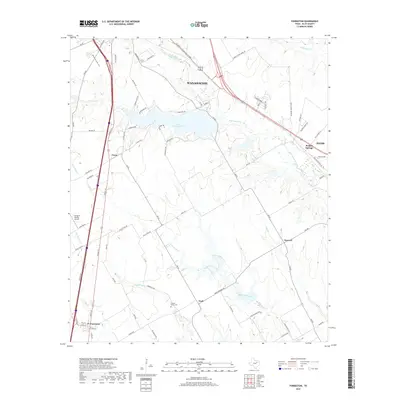
2019 Map of Forreston
USGS Topo · Published 2019About this map
Lake Waxahachie sits at the heart of this Ellis County landscape, its irregular shoreline creating several peninsulas and inlets south of the larger city of Waxahachie. The geography is defined by a dense network of watercourses, including Waxahachie Creek and Little Onion Creek, which snake through the prairie terrain. While the edges of Ennis and the neighborhood of Reagor Springs occupy the eastern portion, the south is characterized by rural communities like Nash and Howard.
Find a feature on this map
77 named features on this map. Tap any name to fly to it.
Don’t see what you’re looking for? This feature index may not catch every label — zoom into the map to look around manually.
Map Details
Editions of this 2019 Forreston Map
This is the sole edition of this map. No revisions or reprints were ever made.
Other maps of this area

1954 · Dallas
USGS Topo · 1:250,000

1956 · Ennis
USGS Topo · 1:62,500

1958 · Dallas
USGS Topo · 1:250,000

1960 · Boz
USGS Topo · 1:24,000

1961 · Forreston
USGS Topo · 1:24,000
1961 · Midlothian
USGS Topo · 1:24,000
1961 · Waxahachie
USGS Topo · 1:24,000

1962 · Ennis West
USGS Topo · 1:24,000

1962 · Cryer Creek
USGS Topo · 1:24,000
1963 · Palmer
USGS Topo · 1:24,000