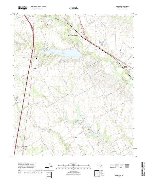
2022 Map of Forreston
USGS Topo · Published 2022About this map
Lake Waxahachie sits as a central reservoir in this part of Ellis County, where the southern outskirts of Waxahachie transition into more rural ranch and farm lands. This modern survey illustrates the persistent importance of water drainage through the plains, following the winding course of Waxahachie Creek and Little Onion Creek southward. Small, historic community hubs like Nash, Howard, and Forreston are connected by a network of farm-to-market roads, while newer developments like Lakeview Memorial Park and the neighborhood around George P Shanks Airport show the area's growth.
Find a feature on this map
80 named features on this map. Tap any name to fly to it.
Don’t see what you’re looking for? This feature index may not catch every label — zoom into the map to look around manually.
Map Details
Editions of this 2022 Forreston Map
This is the sole edition of this map. No revisions or reprints were ever made.
Other maps of this area

1954 · Dallas
USGS Topo · 1:250,000

1956 · Ennis
USGS Topo · 1:62,500

1958 · Dallas
USGS Topo · 1:250,000

1960 · Boz
USGS Topo · 1:24,000

1961 · Forreston
USGS Topo · 1:24,000
1961 · Midlothian
USGS Topo · 1:24,000
1961 · Waxahachie
USGS Topo · 1:24,000

1962 · Ennis West
USGS Topo · 1:24,000

1962 · Cryer Creek
USGS Topo · 1:24,000
1963 · Palmer
USGS Topo · 1:24,000