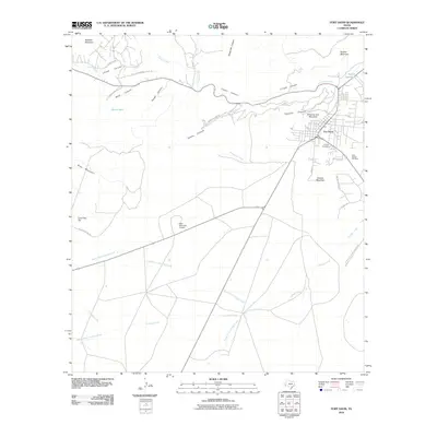
2010 Map of Fort Davis
USGS Topo · Published 2010About this map
Fort Davis occupies the intersection of several deep mountain canyons, where the drainage from Limpia Creek and Chihuahua Creek meets the flatlands. This modern survey illustrates the rugged high-desert geography that has dictated settlement patterns here for over a century, with the community situated between the steep elevations of Sleeping Lion Mountain and Dolores Mountain. Local history and genealogy are anchored by two distinct burial grounds, Pioneer Cemetery and Saint Joseph Cemetery, located near the heart of town.
Find a feature on this map
34 named features on this map. Tap any name to fly to it.
Don’t see what you’re looking for? This feature index may not catch every label — zoom into the map to look around manually.
Map Details
Editions of this 2010 Fort Davis Map
This is the sole edition of this map. No revisions or reprints were ever made.
Other maps of this area

1894 · Valentine
USGS Topo · 1:125,000

1894 · Fort Davis
USGS Topo · 1:125,000

1895 · Marfa
USGS Topo · 1:125,000

1895 · Alpine
USGS Topo · 1:125,000

1897 · Valentine
USGS Topo · 1:125,000

1897 · Fort Davis
USGS Topo · 1:125,000

1943 · Valentine
USGS Topo · 1:125,000

1954 · Fort Stockton
USGS Topo · 1:250,000

1958 · Fort Stockton
USGS Topo · 1:250,000

1959 · Marfa
USGS Topo · 1:250,000