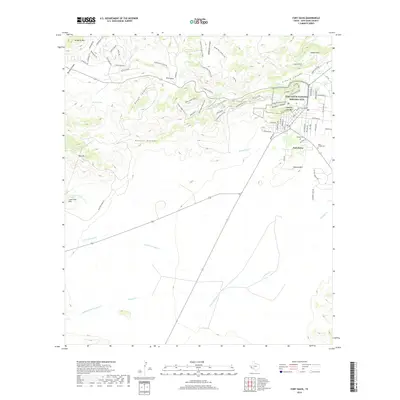
2019 Map of Fort Davis
USGS Topo · Published 2019About this map
The Fort Davis National Historic Site anchors this portion of the Davis Mountains, preserving the footprint of the 19th-century frontier military post. The modern community of Fort Davis sits at the junction of high-desert canyons and drainage systems, where Limpia Creek and Chihuahua Cr flow through the prominent rocky gaps. Evidence of conservation-era labor is visible in the Old CCC Trail and Skyline Drive Trail that wind through the peaks north of town.
Find a feature on this map
77 named features on this map. Tap any name to fly to it.
Don’t see what you’re looking for? This feature index may not catch every label — zoom into the map to look around manually.
Map Details
Editions of this 2019 Fort Davis Map
This is the sole edition of this map. No revisions or reprints were ever made.
Other maps of this area

1894 · Valentine
USGS Topo · 1:125,000

1894 · Fort Davis
USGS Topo · 1:125,000

1895 · Marfa
USGS Topo · 1:125,000

1895 · Alpine
USGS Topo · 1:125,000

1897 · Valentine
USGS Topo · 1:125,000

1897 · Fort Davis
USGS Topo · 1:125,000

1943 · Valentine
USGS Topo · 1:125,000

1954 · Fort Stockton
USGS Topo · 1:250,000

1958 · Fort Stockton
USGS Topo · 1:250,000

1959 · Marfa
USGS Topo · 1:250,000