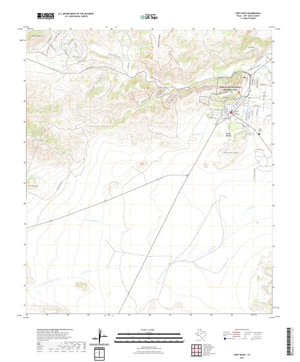
2022 Map of Fort Davis
USGS Topo · Published 2022About this map
The Fort Davis National Historic Site dominates the central landscape of this West Texas quadrangle, preserving the frontier legacy of a post established to protect the San Antonio–El Paso Road. The town of Fort Davis itself spreads southeast of the old fortifications, anchored by the Fort Davis County Courthouse. This 2022 survey details a complex topography of volcanic peaks and deep incisions, where Hospital Canyon and Limpia Canyon provide natural passages through the surrounding heights. Genealogy and local history are marked at several burial grounds, including Pioneer Cem and Saint Joseph Cem, while the modern infrastructure of Prude Guest Ranch RD and Park Road 3 illustrates the area's transition into a center for tourism and preservation. The rugged elevations of Sleeping Lion Mtn and Blue Mtn define the horizons beyond the settled valley floors of Chihuahua Cr.
Find a feature on this map
75 named features on this map. Tap any name to fly to it.
Don’t see what you’re looking for? This feature index may not catch every label — zoom into the map to look around manually.
Map Details
Editions of this 2022 Fort Davis Map
This is the sole edition of this map. No revisions or reprints were ever made.
Other maps of this area

1894 · Valentine
USGS Topo · 1:125,000

1894 · Fort Davis
USGS Topo · 1:125,000

1895 · Marfa
USGS Topo · 1:125,000

1895 · Alpine
USGS Topo · 1:125,000

1897 · Valentine
USGS Topo · 1:125,000

1897 · Fort Davis
USGS Topo · 1:125,000

1943 · Valentine
USGS Topo · 1:125,000

1954 · Fort Stockton
USGS Topo · 1:250,000

1958 · Fort Stockton
USGS Topo · 1:250,000

1959 · Marfa
USGS Topo · 1:250,000