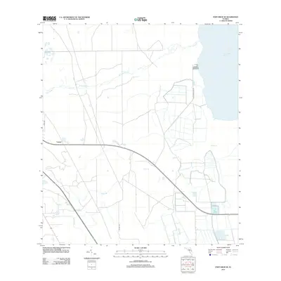
2012 Map of Fort Drum NE
USGS Topo · Published 2012About this map
Yeehaw sits at a critical roadway junction in Osceola County, serving as a primary marker in a landscape defined by expansive drainage networks and seasonal wetlands. The eastern portion of the area is dominated by the vast waters of Blue Cypress Lake, with its shoreline accessed via Blue Cypress Lake Rd. This 2012 survey illustrates the grid of rural tracks and unpaved trails, such as Ne 366th Trl, that crisscross the low-lying terrain to manage water and access remote parcels. Numerous named watercourses, including the winding Blue Cypress Cr and the multi-branched Padgett Br, reveal the natural hydrology of the region before it flows toward the St. Johns River system. The presence of Jim Green Cr and Cow Log Br further highlights the local naming traditions of the Florida cattle and timber lands.
Find a feature on this map
10 named features on this map. Tap any name to fly to it.
Don’t see what you’re looking for? This feature index may not catch every label — zoom into the map to look around manually.
Map Details
Editions of this 2012 Fort Drum NE Map
This is the sole edition of this map. No revisions or reprints were ever made.
Other maps of this area

1953 · Fellsmere SW
USGS Topo · 1:24,000

1953 · Fort Drum
USGS Topo · 1:24,000

1953 · Fort Drum SW
USGS Topo · 1:24,000

1953 · Fort Drum NW
USGS Topo · 1:24,000

1953 · Kenansville SW
USGS Topo · 1:24,000

1953 · Fort Drum NE
USGS Topo · 1:24,000

1953 · Fellsmere 4 SW
USGS Topo · 1:24,000

1953 · Kenansville SE
USGS Topo · 1:24,000

1953 · Fellsmere 4 NW
USGS Topo · 1:24,000

1956 · Fort Pierce
USGS Topo · 1:250,000