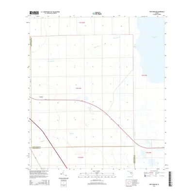
2015 Map of Fort Drum NE
USGS Topo · Published 2015About this map
Yeehaw anchors the central-west portion of this Florida interior landscape, situated near the intersection of Forest Dr and the primary east-west corridor of SR-60. This modern topographic survey illustrates a complex hydrological network where the headwaters and tributaries of several drainage systems meet. The northeastern corner is dominated by the expansive Blue Cypress Lake, which feeds into Blue Cypress Cr. To the south and west, the terrain is defined by smaller watercourses including Padgett Br and Jim Green Cr. The map clearly delineates the convergence of three county lines, tracing the boundaries of Osceola, Indian River, and Okeechobee counties as they divide these marshy lowlands and agricultural tracts.
Find a feature on this map
15 named features on this map. Tap any name to fly to it.
Don’t see what you’re looking for? This feature index may not catch every label — zoom into the map to look around manually.
Map Details
Editions of this 2015 Fort Drum NE Map
This is the sole edition of this map. No revisions or reprints were ever made.
Other maps of this area

1953 · Fellsmere SW
USGS Topo · 1:24,000

1953 · Fort Drum
USGS Topo · 1:24,000

1953 · Fort Drum SW
USGS Topo · 1:24,000

1953 · Fort Drum NW
USGS Topo · 1:24,000

1953 · Kenansville SW
USGS Topo · 1:24,000

1953 · Fort Drum NE
USGS Topo · 1:24,000

1953 · Fellsmere 4 SW
USGS Topo · 1:24,000

1953 · Kenansville SE
USGS Topo · 1:24,000

1953 · Fellsmere 4 NW
USGS Topo · 1:24,000

1956 · Fort Pierce
USGS Topo · 1:250,000