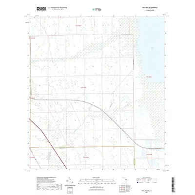
2021 Map of Fort Drum NE
USGS Topo · Published 2021About this map
Blue Cypress Lake dominates the eastern landscape of this Florida region, its shoreline defined by intricate wetland systems and seasonal drainage patterns. The interior of the quadrangle is a network of marshes and cypress strands, where water moves through slow-moving channels like Blue Cypress Cr and the multiple reaches of Padgett Br. This area represents a critical hydrological transition point where the boundaries of Osceola, Indian River, and Okeechobee counties meet amidst a landscape of cattle ranching and conservation.
Find a feature on this map
14 named features on this map. Tap any name to fly to it.
Don’t see what you’re looking for? This feature index may not catch every label — zoom into the map to look around manually.
Map Details
Editions of this 2021 Fort Drum NE Map
This is the sole edition of this map. No revisions or reprints were ever made.
Other maps of this area

1953 · Fellsmere SW
USGS Topo · 1:24,000

1953 · Fort Drum
USGS Topo · 1:24,000

1953 · Fort Drum SW
USGS Topo · 1:24,000

1953 · Fort Drum NW
USGS Topo · 1:24,000

1953 · Kenansville SW
USGS Topo · 1:24,000

1953 · Fort Drum NE
USGS Topo · 1:24,000

1953 · Fellsmere 4 SW
USGS Topo · 1:24,000

1953 · Kenansville SE
USGS Topo · 1:24,000

1953 · Fellsmere 4 NW
USGS Topo · 1:24,000

1956 · Fort Pierce
USGS Topo · 1:250,000