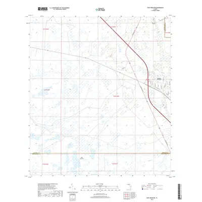
2018 Map of Fort Drum NW
USGS Topo · Published 2018About this map
Yeehaw Junction stands at the crossroads of Central Florida in this late 2010s survey, marking a distinct intersection of transportation and wetland terrain. The landscape is defined by the headwaters and drainages of the Blue Cypress Creek system, where the environment shifts between open marsh and slightly higher ground like Wolf Hammock. To the south and west, the map details the intricate hydrography of Little Gumhead Marsh and seasonal waterways such as Cow Log Br and Padgett Br. This area serves as a critical boundary zone, where the lines of Osceola, Indian River, and Okeechobee Counties meet amidst a network of rural routes. While the junction itself shows a concentrated grid including Central Blvd and Tropical Ave, much of the surrounding quadrangle remains dominated by the natural drainage patterns of the Florida interior, punctuated by landmarks like Big Lolly Bridge.
Find a feature on this map
29 named features on this map. Tap any name to fly to it.
Don’t see what you’re looking for? This feature index may not catch every label — zoom into the map to look around manually.
Map Details
Editions of this 2018 Fort Drum NW Map
This is the sole edition of this map. No revisions or reprints were ever made.
Other maps of this area

1953 · Fort Drum
USGS Topo · 1:24,000

1953 · Fort Kissimmee NE
USGS Topo · 1:24,000

1953 · Fort Drum SW
USGS Topo · 1:24,000

1953 · Lake Marian SE
USGS Topo · 1:24,000

1953 · Fort Drum NW
USGS Topo · 1:24,000

1953 · Kenansville SW
USGS Topo · 1:24,000

1953 · Fort Drum NE
USGS Topo · 1:24,000

1953 · Kenansville SE
USGS Topo · 1:24,000

1953 · Fort Kissimmee SE
USGS Topo · 1:24,000

1956 · Fort Pierce
USGS Topo · 1:250,000