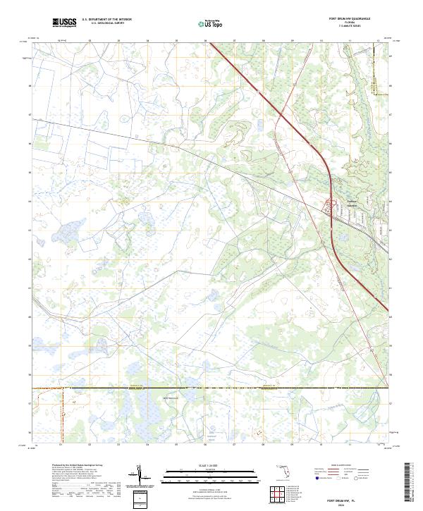
2024 Map of Fort Drum NW
USGS Topo · Published 2024About this map
Yeehaw Junction serves as the central hub of this South Florida landscape, where major transit corridors intersect amidst a vast mosaic of wetlands and conservation lands. The map documents a critical ecological boundary where the Osceola Co Okeechobee Co line divides the terrain, and the Everglades Headwaters National Wildlife Refuge and Conservation Area protects large swaths of the headwaters. Local hydrology is defined by slow-moving water bodies like Cow Log Branch, Padgett Branch, and the Little Gumhead Marsh. Settlement patterns are concentrated near the junction, with a grid of residential streets including Tropical Ave and Central Blvd set against the expansive natural features of Wolf Hammock and the Kissimmee Prairie Preserve State Park Trl.
Find a feature on this map
31 named features on this map. Tap any name to fly to it.
Don’t see what you’re looking for? This feature index may not catch every label — zoom into the map to look around manually.
Map Details
Editions of this 2024 Fort Drum NW Map
This is the sole edition of this map. No revisions or reprints were ever made.
Other maps of this area

1953 · Fort Drum
USGS Topo · 1:24,000

1953 · Fort Kissimmee NE
USGS Topo · 1:24,000

1953 · Fort Drum SW
USGS Topo · 1:24,000

1953 · Lake Marian SE
USGS Topo · 1:24,000

1953 · Fort Drum NW
USGS Topo · 1:24,000

1953 · Kenansville SW
USGS Topo · 1:24,000

1953 · Fort Drum NE
USGS Topo · 1:24,000

1953 · Kenansville SE
USGS Topo · 1:24,000

1953 · Fort Kissimmee SE
USGS Topo · 1:24,000

1956 · Fort Pierce
USGS Topo · 1:250,000