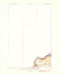
1935 Map of Fort Kent
USGS Topo · Published 1945About this map
Fort Kent stands as a vital border settlement in the mid-1930s, situated at the confluence of the Fish River and the St John River. This area of northern Aroostook County is defined by the international boundary between Canada and the United States, where the river serves as both a border and a corridor for regional transport. The Bangor and Aroostook railroad line provides a critical link for the logging and agricultural community, following the curve of the St John River. Educational life is anchored by local institutions such as Roosevelt Sch, Hillside Sch, and Blaine Sch, which are scattered near the town center and surrounding hills. The landscape is deeply etched by waterways like Audibert Brook and Daigle Bk, which drain the rolling terrain of Fort Kent and support the local timber-driven economy during this era of early aerial survey mapping.
Find a feature on this map
12 named features on this map. Tap any name to fly to it.
Don’t see what you’re looking for? This feature index may not catch every label — zoom into the map to look around manually.
Map Details
Editions of this 1935 Fort Kent Map
3 editions found
Other maps of this area

1927 · Square Lake
USGS Topo · 1:48,000

1928 · Eagle Lake
USGS Topo · 1:48,000

1930 · St Francis
USGS Topo · 1:48,000

1931 · Square Lake
USGS Topo · 1:62,500

1931 · Eagle Lake
USGS Topo · 1:62,500

1932 · Frenchville
USGS Topo · 1:48,000

1932 · Fort Kent
USGS Topo · 1:48,000

1933 · St Francis
USGS Topo · 1:62,500

1935 · Fort Kent
USGS Topo · 1:62,500

1935 · Frenchville
USGS Topo · 1:62,500