1963 Map of Fort Lauderdale 2 SE
USGS Topo · Published 1983About this map
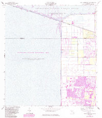
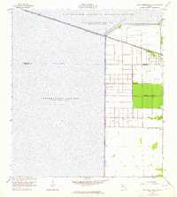
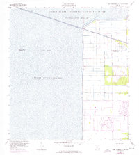
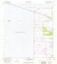
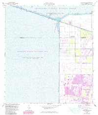
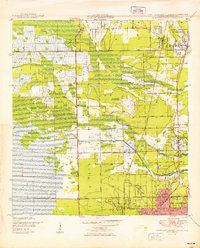
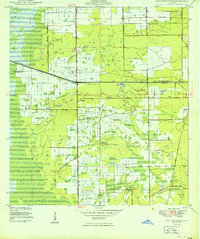
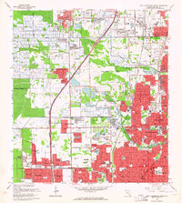
Coral Springs and Parkland anchor the southeastern portion of this map, showcasing the dramatic intersection of South Florida's urban expansion and its preserved wetlands. The 1983 revisions, indicated in purple, reveal the rapid suburbanization of what was recently agricultural land, with housing developments and a Golf Course pushing right against the massive water management infrastructure. This edge is defined by Levee No 36, a stark vertical boundary that separates the residential grid from the Everglades Wildlife Management Area. To the north, the Hillsboro Canal serves as a critical artery, flanked by the Hillsboro Canal Road and marking the southern limit of the Loxahatchee National Wildlife Refuge. The map provides a detailed view of the complex hydrology of Conservation Area No 1 and Conservation Area No 2, where water is impounded periodically to manage the region's delicate environment.
Find a feature on this map
20 named features on this map. Tap any name to fly to it.
Don’t see what you’re looking for? This feature index may not catch every label — zoom into the map to look around manually.
Map Details
Editions of this 1963 Fort Lauderdale 2 SE Map
5 editions found
Other maps of this area

1945 · Fort Lauderdale North
USGS Topo · 1:24,000

1946 · West Dixie Bend
USGS Topo · 1:24,000

1947 · Delmar Farms
USGS Topo · 1:24,000
1949 · Fort Lauderdale North
USGS Topo · 1:24,000
1949 · West Dixie Bend
USGS Topo · 1:24,000
1949 · Delmar Farms
USGS Topo · 1:24,000

1956 · West Palm Beach
USGS Topo · 1:250,000

1957 · West Palm Beach
USGS Topo · 1:250,000

1958 · West Palm Beach
USGS Topo · 1:250,000
1962 · Fort Lauderdale North
USGS Topo · 1:24,000