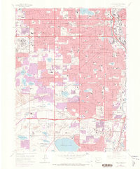
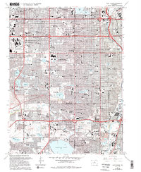
1965 Map of Fort Logan
USGS Topo · Published 1973About this map
The western suburbs of Denver display a rapidly maturing postwar landscape on this map, which tracks the expansion of Lakewood and Edgewater during the mid-1960s. The massive Denver Federal Center occupies a significant tract in the west, while the eastern edge follows the Platte River corridor through Sheridan and Englewood. The region is defined by a dense network of educational and institutional landmarks, ranging from the hilltop campus of Loretto Heights College to the sprawling Federal Correctional Institute near Henry Lake. Water management is central to the area's development, evidenced by the large Marston Lake and a series of smaller impoundments like Kendrick Reservoir and Sloans Lake. Local recreation and community life are anchored by the Lakewood Country Club and numerous parochial schools including St Anthony of Padua Sch and St Bernadette Sch.
Find a feature on this map
104 named features on this map. Tap any name to fly to it.
Don’t see what you’re looking for? This feature index may not catch every label — zoom into the map to look around manually.
Map Details
Editions of this 1965 Fort Logan Map
5 editions found
Other maps of this area

1890 · East Denver
USGS Topo · 1:125,000

1899 · West Denver
USGS Topo · 1:125,000

1935 · East Denver Nos. 3 and 4
USGS Topo · 1:48,000

1938 · Morrison
USGS Topo · 1:24,000

1938 · Derby
USGS Topo · 1:24,000

1939 · Golden
USGS Topo · 1:24,000

1940 · Englewood
USGS Topo · 1:31,680

1940 · Derby
USGS Topo · 1:31,680

1941 · Arvada
USGS Topo · 1:31,680

1941 · Fort Logan
USGS Topo · 1:31,680